Tag: adventure

  • Shenandoah Section Hike Day 4/6

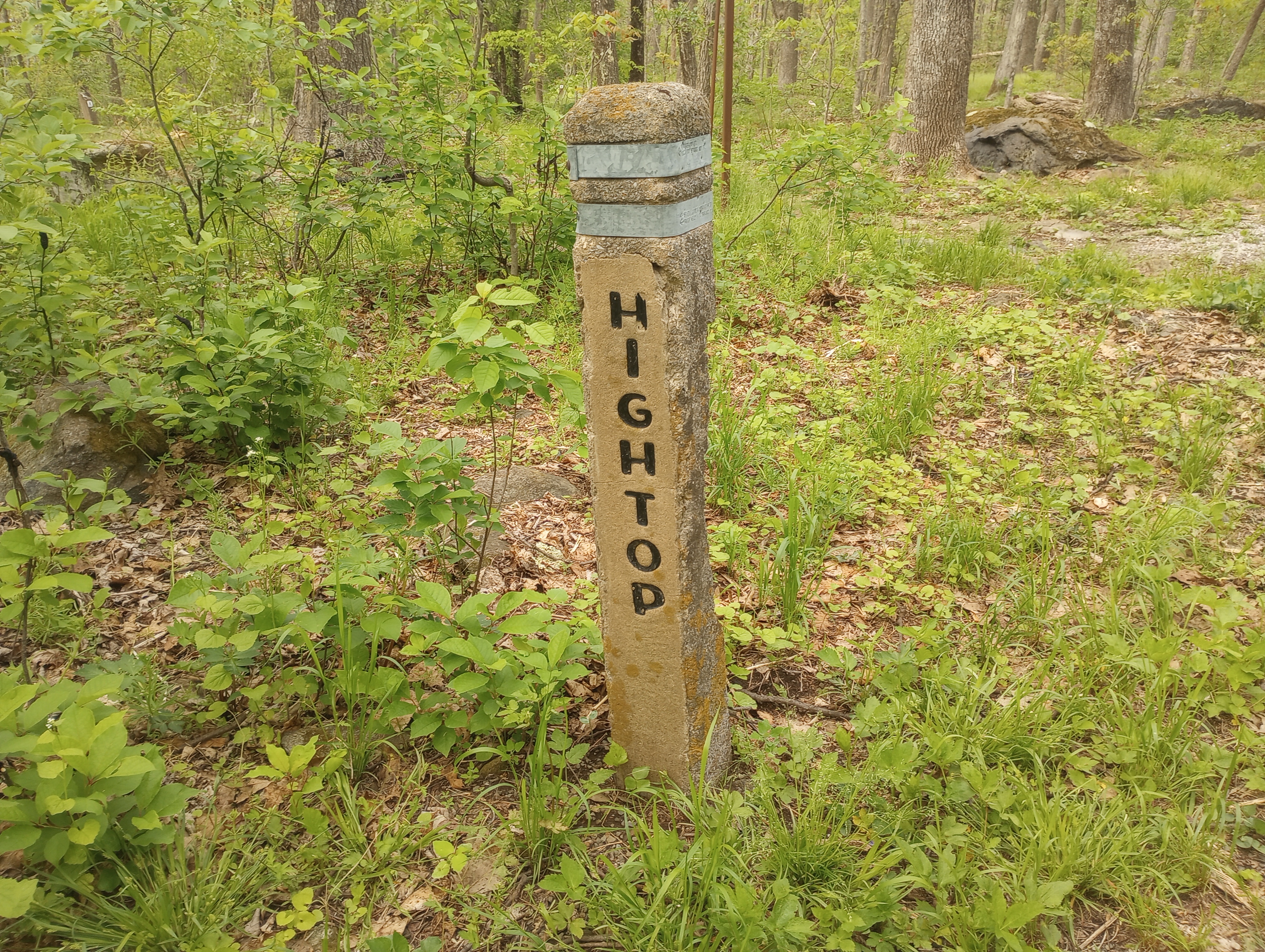
    Saturday 5/10/25 Day 4 of my Shenandoah section hike. Plan for day was 7.3 miles to Blackrock Mountain Hut including a 600 ft climb to Blackrock Mountain.

    It got cold and windy overnight. I did not get a good rest because I was worried about hiking in the cold and wind the next day. I was not really prepared for cold weather. When I left Loft campground at 7 am the winds had died. I forgot to set my watch at the start of my hike, so my stats do not include the whole hike.

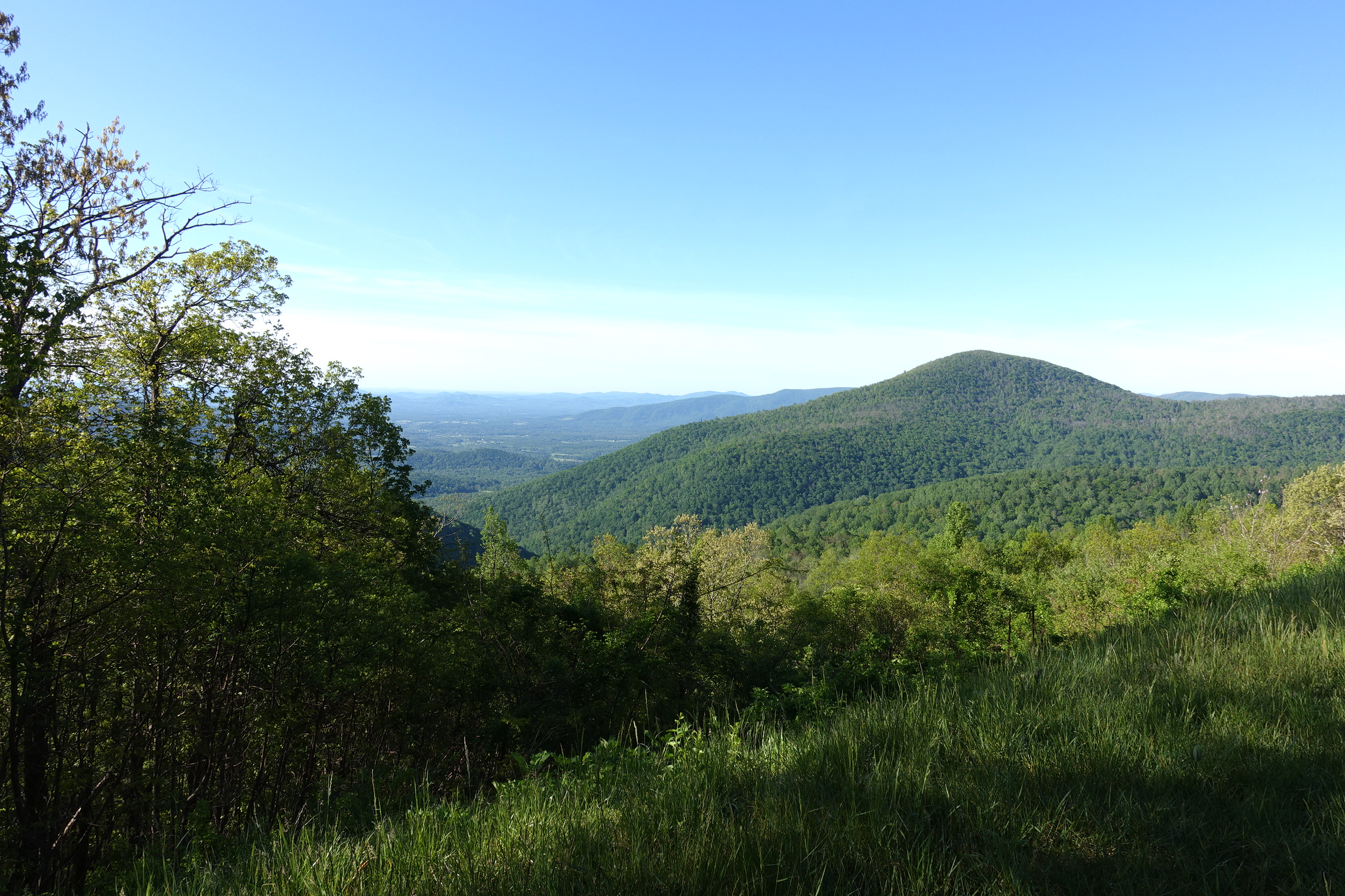
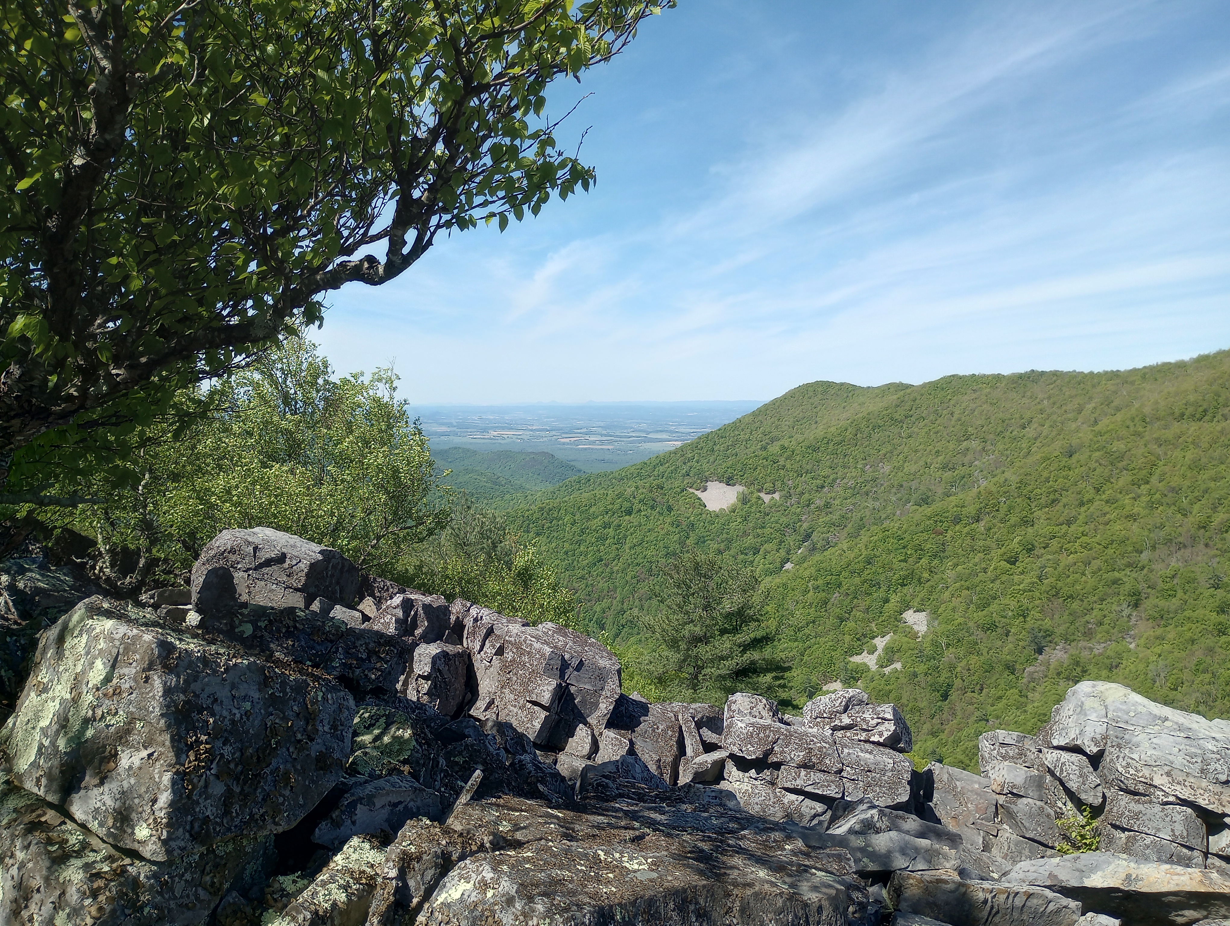
    The trail seemed easier today. Not sure I it was the terrain or I was getting some “hiking legs”. I was surprised on how fast the miles went today. Even the climb up Blackrock was not that bad…. day would have been perfect if I did not take the wrong trail off the top of the mountain and had to climb back up to get back on the AT.

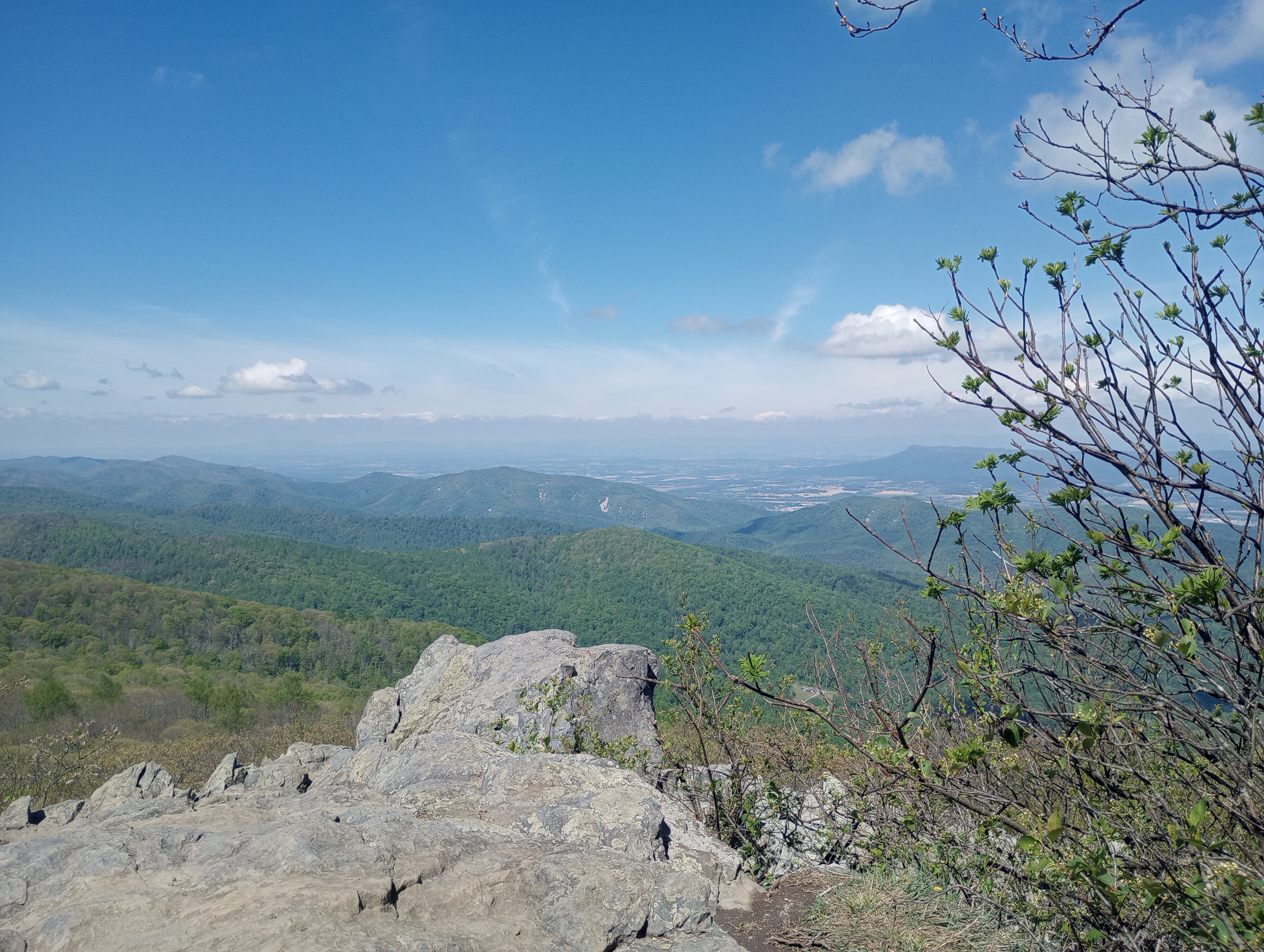
    Blackrock is a popular day hike and it was Saturday so there were many people on the trail. The rocks that make up the mountain were crazy… I would be interested in knowing how these were formed.

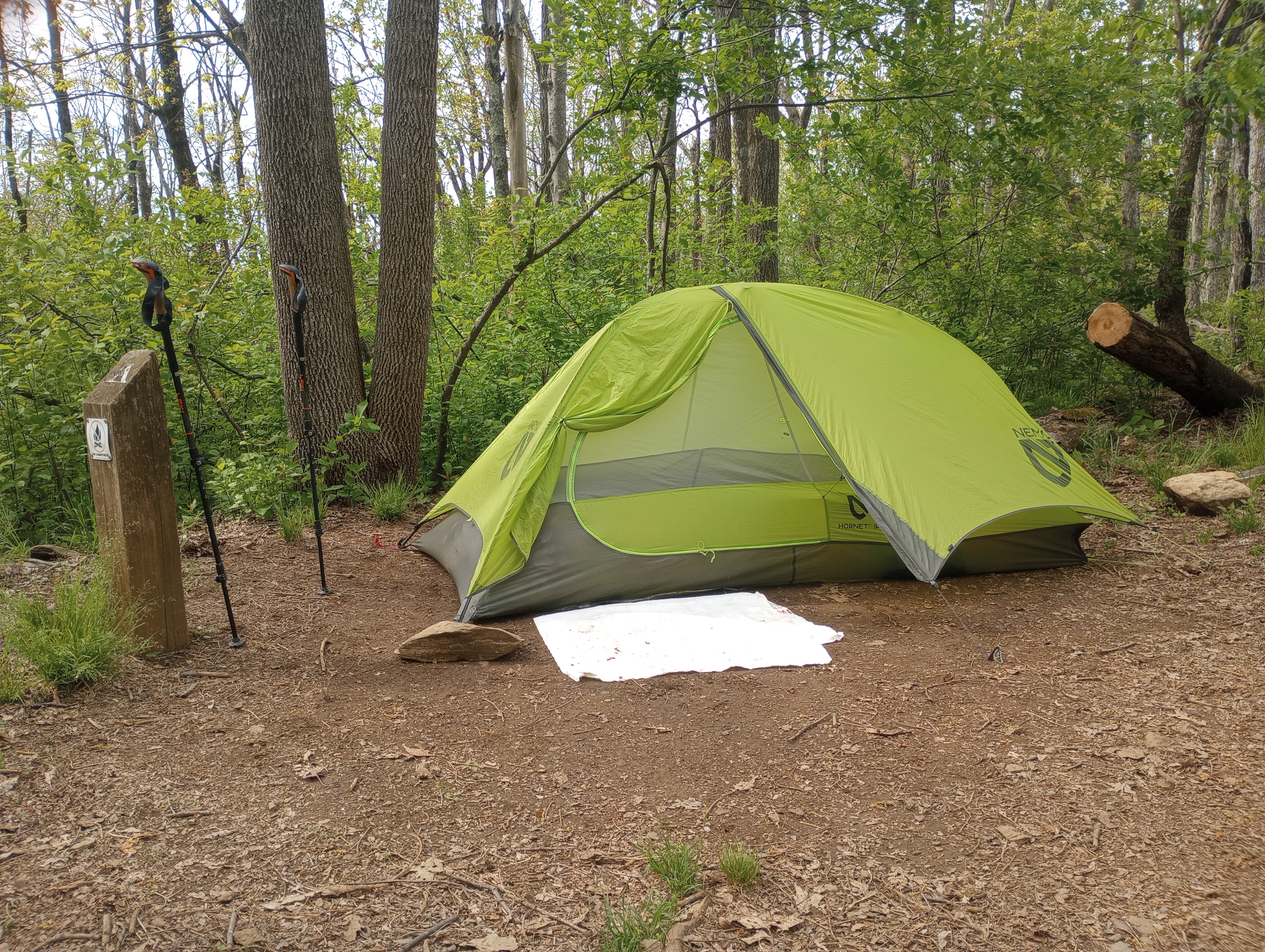
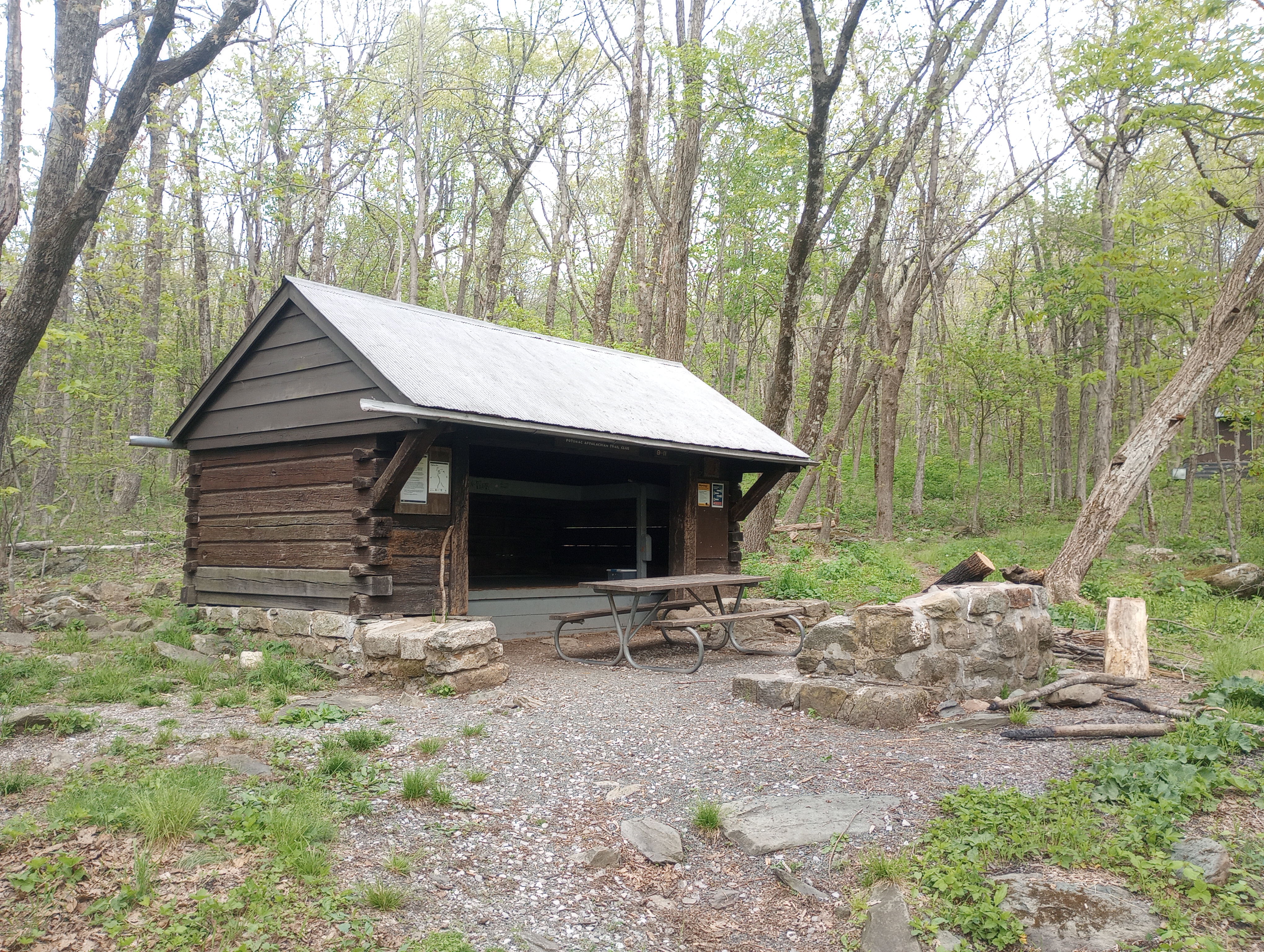
    Got into the Shelter / Hut fairly early and was lucking to have only one other hiker staying overnight. I was able to snag the one prime spot for the tent behind the shelter. You can see in the photo I do carry a 18 ounce chair. This may be a luxury item but I find it much better than sitting on log.

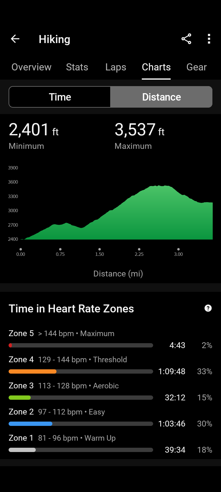
    Recorded stats for day: 6.96 miles, 1042 total ascent, 4hr 03 min, 1.7mph

  • Shenandoah Section Hike Day 1/6

    May 7, 2025 – First day of a 6 day / 45 mile section hike on the Appalachian Trail in the Shenandoah National Park SOBO from Swift Run to Rockfish Gap.

    Left my car near the Rockfish Gap entrance to SNP. My shuttle driver Mary drove me the 1.5 hours to the Swift Run Gap, We traded lots of hiking stories as she has completed most of the trail as a section hiker.

    Had some breakfast at the side of the road on the rock fence and stated out of the the trail. The plan for the day was short on miles but with a significant climb (significant for me) up Hightop Mountain. Spent a good amount of time at the overlook before heading into the Hightop Hut (Shelter).

    The weather was sunny and warm…. too warm for a nap in the tent… smiles. Had the whole shelter area to myself no other hikers stayed the night but did see a number stop for a water fill up.

    Stats for the day: 3.66 miles, 1298 ft elevation, 3 hours 30 Min, ave speed 1.0 mph,

  • Time to finish what I started

    It is time to finish what I started 8 years ago…

    The original Appalachian Trail section hike that started it all for me was planned for the fall of 2017. This was the year I turned 60 and when my many years of being a “soccer dad” came to end. (I am sure you are all saying “you don’t look that old”- smiles).

    The original plan was to hike NOBO (North bound) from Pearisburg VA (mile 637.5) to Daleville VA (mile 730.6) for a total planned hike of 93.1 miles. I think I had planned to do this in 8 to 10 days. This section includes some famous and popular spots on the trail dubbed the “triple crown”. Dragons Tooth. McAfee Knows and Tinkers Cliffs. There are many iconic photos of the AT with a hikers standing on a cantilevered rock I am sure you have seen… this is McAfee Knob.

    I had some backpacking experience from weekends in the Allegany Forest in PA so I was not a complete newb. I borrowed some equipment from my son, bought some new equipment and did some exercise and walking to prepare.

    As the time approached I decided 93 miles was bit too much to handle on my first hike and decided to change and start at Mountain Lake road access (mile 664.5) . This by the way is near the resort where the movie Dirty Dancing was filmed. This would take 27 miles off the original plan…

    I parked my car in Daleville and hired a shuttle to take me to the start of my hike. The first day was a bit of a challenge but is was all down hill so real problems. The second day I learned how poorly I was prepared and what a physical challenge the AT can be, especially in Virginia. I hiked uphill for more than 8 hours during which time I hit a wall and was only able to take 5 steps without stopping. The final uphill was a 500 ft climb in 1/2 mile up to Kelly’s Knob. I got some moral support on the final push from some experienced section hikers and hobbled into Laurel Creek Shelter.

    That night I had no desired to eat, but the other hikers convinced me I needed to eat. The next day I took a “zero” and slept in the shelter all day. The third day I started back on trail but knew I would never make it all the way to Daleville. A few miles in there was a road, I hitched a ride and my first section hike was over after only 14 miles.

    Some lessons learned

    • need lighter weight equipment and boots
    • must have trekking poles
    • you will eat much less food than you plan
    • must eat breakfast in the morning before starting a hike

    Over the last 7 years I have completed a number of hikes in this section. My longest was 35 miles over 4 days that included Dragon’s Tooth. After moving to North Carolina in 2022 I have become a much better hiker and am able to handle the mountain climbs – for the most part. I am down to the last 20 miles to finish my original plan. This will be completed next week in first hike of this adventure including my first trip to McAfee Knob and maybe a sunrise photo like below. It’s about time.

  • Why “Mapless” ?

    I have been an Appalachian Trail Section hiker since 2017. I have accumulated 225 miles over numerous multi day hikes. For me, a section hike must be planned at least 3 days and 2 nights on the trail to “count” towards these miles. “Day hikes” do not count.

    On of my first hikes was in the Shenandoah National Park where the trail follows the Skyline drive. On the first day of hiking I had paper copies of the AT Guide in a zip lock in my pocket. The guide is more or less a map of the trail with details on mileages, elevations, shelters, place to camp, water sources as well as many other details of the trail.

    When I stopped for my first rest stop the zip lock was no where to be found!

    I must have dropped it somewhere on the trail.

    The backup to the paper maps was an app for the phone called GutHook (now called Far Out). I never wanted to use the app because I wanted to save the battery on my phone and this was why I chose to always carry the paper. But when I turned on my phone to use it, the app would not open, nada, zip!!

    For the rest of the day I followed the trail without my copies of the guide and no access to the Guthook app. It is very hard to get lost following the AT but I love the guide to tell me how far I have gone and how far I have left to go to my destination for the day.

    That evening I camped at a shelter (called huts in the SNP for some reason) with other hikers and told my story of my missing guide pages and the phone app that would not open… as a result, I was given the name of “mapless”

    Luckily another hiker arrived with my zip lock bag they had found and I was only mapless for a day, but now have the trail name forever… once you are given a trail name it is always your trail name per the trail rules…